Usage
NLDI Flowtools provides two tools: Split Catchment for basin delineation and Flow Trace for raindrop path tracing. Both accept WGS 84 longitude/latitude coordinates and return GeoJSON FeatureCollections.
from nldi_flowtools.nldi_flowtools import splitcatchment, flowtrace
Tip
When delineating a point on a stream, run it through flowtrace first to
snap the point to the flowline. Use the returned intersection point as input
to splitcatchment for the most accurate basin boundary.
Flow Trace
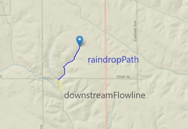
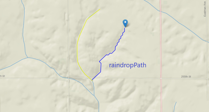
Traces the raindrop path from an input point downhill along a 30m flow direction grid until it intersects an NHD flowline. Returns the traced path and the intersected stream segment.
Parameters
Name |
Type |
Description |
|---|---|---|
|
float |
Longitude in WGS 84 decimal degrees. |
|
float |
Latitude in WGS 84 decimal degrees. |
|
str |
Which portion of the intersected flowline to return:
|
Returns
A GeoJSON FeatureCollection with two features:
Feature ID |
Description |
|---|---|
|
The NHD stream segment (varies by |
|
The traced flow path from the input point to the stream. |
Examples
Downstream trace:
flowtrace(-93.17298889291125, 41.99318001025908, "down")
Upstream trace:
flowtrace(-93.17298889291125, 41.99318001025908, "up")
Algorithm Details
The raindrop path follows a 30m NHDPlus V2 flow direction grid from the query point downhill to an NHD flowline.
The intersection point is constrained to a flow accumulation cell value of 900 or greater, ensuring the trace lands on a meaningful stream cell.
If the trace extends beyond the local catchment before reaching a flowline, an additional NLDI query fetches the downstream catchment and flowline data automatically.
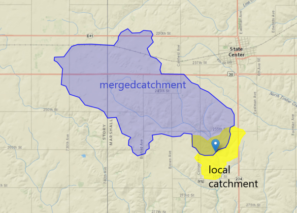
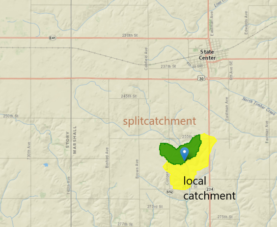
Split Catchment
Identifies the NHD catchment containing a point and delineates the upstream contributing area. Can return either the local split portion or the full upstream drainage basin.
Parameters
Name |
Type |
Description |
|---|---|---|
|
float |
Longitude in WGS 84 decimal degrees. |
|
float |
Latitude in WGS 84 decimal degrees. |
|
bool |
|
|
bool |
|
Returns
A GeoJSON FeatureCollection with two features:
Feature ID |
Description |
|---|---|
|
The local NHD catchment polygon. Includes a |
|
The portion of the catchment upstream of the point
(returned when |
|
The full upstream drainage basin
(returned when |
Examples
Full upstream basin:
splitcatchment(-93.02933761928982, 41.79037842455216, True, False)
Local split catchment only:
splitcatchment(-93.02933761928982, 41.79037842455216, False, False)
Notes
Split Catchment does not snap the input point to the NHD flowline. For stream-based delineations, use
flowtracefirst to get the intersection point, then pass that tosplitcatchment.The
simplifiedparameter only affects the upstream basin geometry requested from NLDI. The local split catchment is always full-resolution.